
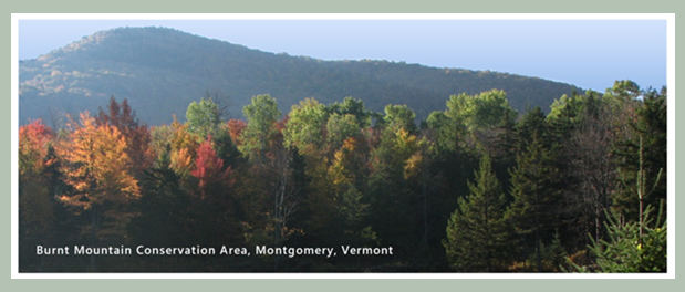
Burnt Mountain Conservation Area |
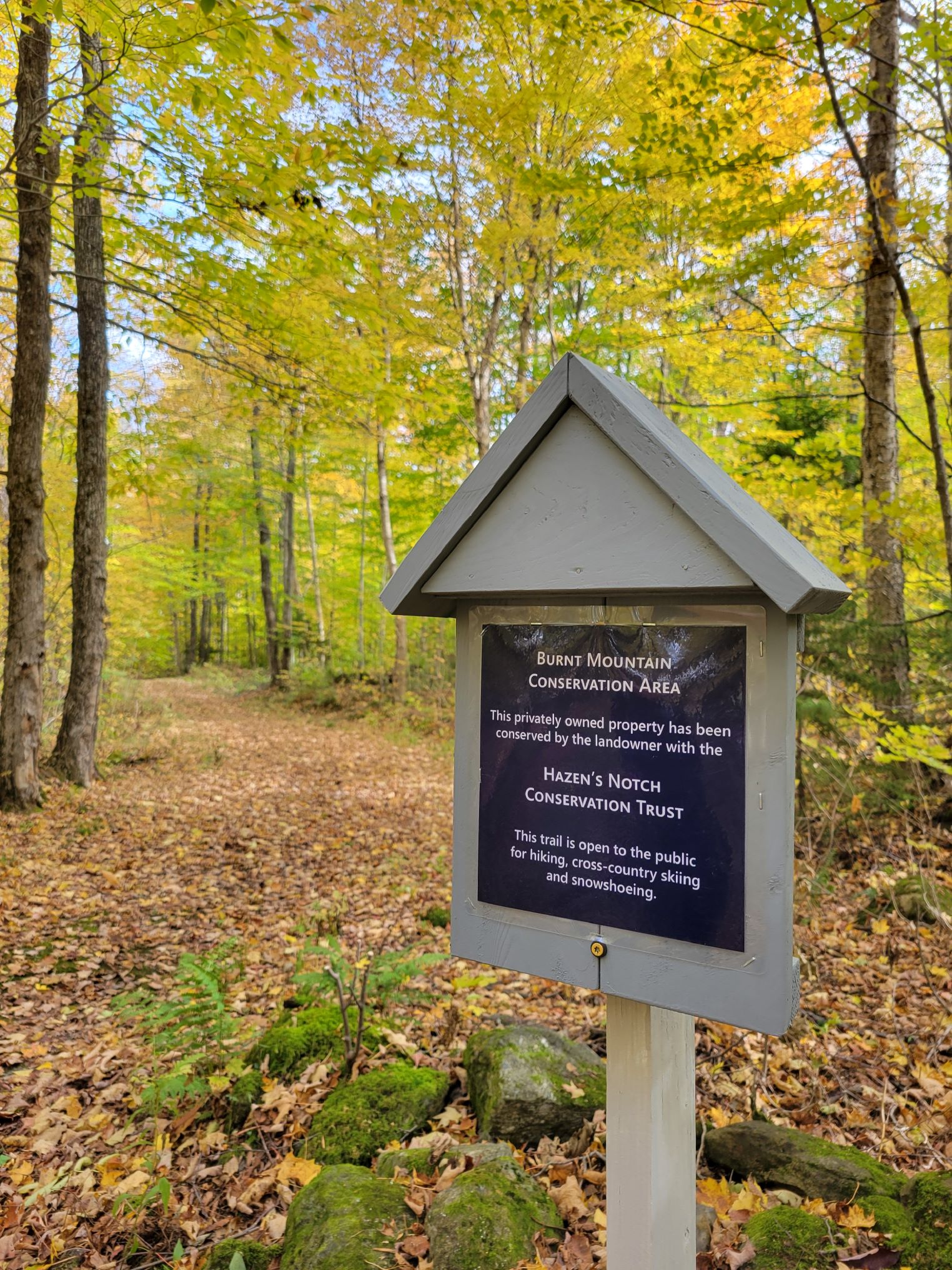
The Burnt Mountain Conservation Area in the Hazen's Notch area of Montgomery, Vermont is a privately owned woodland on the northwestern face of Burnt Mountain. The 160-acre property was purchased by Rolf Anderson in August of 1996. The Hazen's Notch Conservation Trust (HNCT) conserved this 160-acre conservation area on November 13, 2023. The conservation easement held by the HNCT protects the natural resources, wildlife habitat and two popular pedestrian trails on the Burnt Mountain Conservation Area.
>> A recent video created by the Hazen's Notch Conservation Trust and posted to their Facebook page and Instagram account is meant to portray the Burnt Mountain Conservation Area. The video may give viewers the impression that the High Ponds Farm has been conserved. It has not. The video may also give viewers the impression that the Burnt Mountain Conservation Area and The High Ponds Farm are all one property. They are not. <<
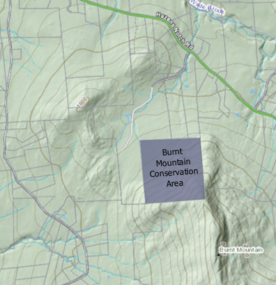
This moderately steep woodland is one of the original lots dating from the founding of Montgomery. The forest is primarily a mix of common hardwood tree species including maple, birch and beech. An outcrop of the underlying bedrock appears midway on the slope which leads to an area of Montane Yellow Birch Red Spruce Forest which transitions to an area of Montane Red Spruce and Balsam Fir Forest in the southeast corner of the parcel. This 160-acre parcel rises approximately 1,020 feet in elevation from its NW corner (1,470 ft.) to its SE corner (elev. 2,490 ft.).
The parcel contains mid-elevation habitat that is appealing to the following bird species: Black-capped Chickadee, Red-breasted Nuthatch, Hermit Thrush, American Robin, Solitary Vireo, Red-eyed Vireo, Black-throated Blue Warbler, Yellow-rumped Warbler, Black-throated Green Warbler, Scarlet Tanager, White-throated Sparrow, Dark-eyed Junco. The small area of higher elevation forest occasionally entices a Blackpoll Warbler to visit. (Benjamin, D.)
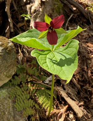
The soils at the lower elevation of the parcel are somewhat rich in nutrients. Two small streams begin on the parcel and eventually flow into Flood Brook. Spring wildflowers found here include Wild Leeks, Jack-in-the-pulpit, Creeping Snowberry, Bluebead Lily, Canada Mayflower, and Red Trillium. Ferns through Summer include Maidenhair Fern, Lady Fern, Hay-scented Fern, Silvery Glade Fern, Mountain Wood Fern, Intermediate Wood Fern, Christmas Fern and New York Fern. Purple-flowered Raspberry, Hobblebush and Jewel Weed (both orange and yellow species) bloom profusely along the two wood roads/trails on the parcel. (Benjamin, D.)
White-tailed deer, Ruffed grouse, and Black bear are frequently seen. Moose, Bobcat and Snowshoe hare have also been seen from time to time.
While the property was never developed and no evidence of former structures exists, the Burnt Mountain Conservation Area is adjacent to the High Ponds Farm which was an upland subsistence farm owned and operated by Rodney and Mary Elizabeth (Hayes) Dodge and one of their sons, John Rodney Dodge and his wife Mary Elizabeth (Gilmore) Dodge for 72 years from 1876 to 1948. Within 0.1 mile of the northwest corner of the Burnt Mountain property was the Rodney and Mary Elizabeth Dodge farmhouse (22 ft. x 24 ft.) a barn (24 ft. x 40 ft.), and a small sugar house located on the former Dodge Farm, now known as High Ponds Farm. While the three buildings are gone, the foundations remain. (Sherman, J.)
In August of 2021, an 8 ft. x 20 ft. wooden frame and wood decked bridge was constructed over Black Bear Brook in the northwest corner of the parcel. The bridge was designed for safe passage by pedestrian trail users to include hikers, snowshoers, and cross country skiers.
The conservation easement held by the Hazen's Notch Conservation Trust prohibits all subdivision and development of the 160-acre woodland.
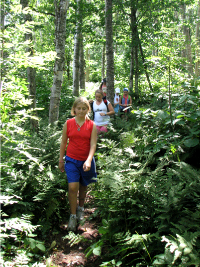
Two trails have been conserved for pedestrian recreation with the conservation easement. A one-quarter mile portion of the Notch Trail is a remnant of a historic log-hauling road dating from the late 19th and early 20th Centuries. This woods road was used to haul logs from Hazen's Notch to a mill which once stood at the foot of the Reagan Road. The second trail is a restored woods road which leads to a footpath laid out by Rolf Anderson in the 1990s so that the public could hike or snowshoe to the summit of Burnt Mountain which lies a short distance to the south of the property.
Access: Pedestrian only. Visitors may access the property by way of trails and woods roads on the adjacent High Ponds Farm, a private property which is open to the public on a limited basis.
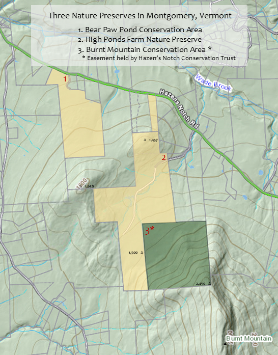
The Burnt Mountain Conservation Area lies within an area designated by the Vermont Department of Fish and Wildlife as a highest priority, interior forest block for conservation. The Burnt Mountain Conservation Area has strong natural resource values which support native plant communities, biodiversity, wildlife habitat, wildlife corridor, structural and functional connectivity with adjacent conservation lands, numerous woodland seeps, vernal pools, and two streams which rise on the property.
Professional foresters and naturalists have made detailed inventories and assessments of the flora and fauna present. Numerous areas with rich forest soils and mature trees provide ideal conditions for woodland plants. The Stewardship Management Plan emphasizes biological diversity and forest health, protection of forest soils, wetlands, and riparian areas, protection of habitat for interior forest birds and mammals, and protecting corridor connectivity with adjacent conservation lands. The conservation easement held by the Hazen's Notch Conservation Trust includes requirements and restrictions relating to forest management activities on the property.
For complete visitor information, see the website of the Hazen's Notch Association: www.hazensnotch.org
Hazen's Notch Trails Map 2024
High Ponds Farm + Burnt Mountain Area Map 2024
High Ponds Farm and Burnt Mountain Area Suggested Routes 2024.jpg
The Hazen's Notch Conservation Trust was formed to conserve wildlife habitats, soil and water resources, undeveloped open space and natural areas, and non-motorized recreational trails. HNCT works with interested landowners to explore outdoor recreation opportunities compatible with their property and land management philosophy. A priority for the HNCT is to conserve parcels adjacent to existing conserved lands in order to expand protection of wildlife corridors and habitats.
Website: Hazen's Notch Conservation Trust, Inc.
References